"This wonderful byproduct of glacial neglect."
The second Ten Thousand was building up to be an even better event. Instead of fighting the heat, humidity, and bugs of a midwestern July, the organizers moved the event to the cool crisp autumn. The start location had been moved further west to allow for even more climbing. Then it all fell apart. Through a various set of unforeseen circumstances the organizers quit their jobs, and moved to different cities. There was no one left to host the event, and no one to shake hands at the finish. All that was left was a time, a date, and a cue sheet.
That was enough for me though. If your friend spends hours making you a mix tape, the least you can do is listen to it, right? I had spent the spring and summer training for longer harder events. I raced in three endurance mountain bike races of 33 miles, 57 miles, and 100 miles, and put in the training time required to not just finish but to finish pretty well for a first timer. By the end of September I had put in 4,300 miles with 172,000 ft of climbing which was 200 miles and 25,000 ft more than I had done in all of 2014. I was ready for the event.
It took a little negotiation to get my team manager (i.e., my wife Morleigh) on board. Her biggest concern was that I was going to try to do something foolish like ride the Ten Thousand on Saturday and then race a cyclcross race on Sunday. We talked it over and I promised that if I did the full Ten Thousand route I would not do something so foolish as to try to race cyclocross on Sunday. Once the pinky swear promise was in place she agreed to be awesome and set up a SnowyMountain Photography rest stop for riders as she had done for the last three Axletree events.
The wrong foot
The alarm went off at 5:45AM, were at breakfast by 6AM, car loaded and on the road by 6:30AM. I was hoping to be gone a little bit earlier, as it was a 25 minute ride to the start with a posted start-time of 7AM. We were cutting it close, but I had been planning and rehearsing my routine for getting dressed and ready for days. I thought for sure it would be no problem getting ready.
The weather forecast was very pleasant for mid-October. There was a frost-warning overnight, and temps were supposed to be in the low 30s when the ride started with a high in the low 50s. I erred on the side of not being too warm, and opted for summer mountain bike shoes with over the calf wool socks and toe warmers, a craft base layer under regular bib shorts, and then an Under Armor base layer under a jersey, wool arm warmers, and a Sugoi wind-stopper jacket with magnetically attached sleeves that could be pulled off and stowed quickly. I had some long finger gloves, a craft hat and a secondary ear-band. I was counting on it warming up pretty quickly. That never happened, it didn't warm up at all.
The second faux pas I made was thinking that I could carry one of our digital SLR cameras for the entire ride. Morleigh was very concerned about the burden of extra weight slowing me down, and the risk to equipment if I were to take a tumble. I agreed, but still wanted to give it a go. I figured the worst that would happen would be that I would get some good pictures during the golden hour and then drop the camera at the first aid station which was going to be at about 41 miles if need be. That didn't work out either.
The grand depart
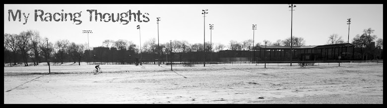
 |
| 7:08 AM - Riders gather in Stockton, IL for the start of the Ten Thousand |
The sun was just starting to climb over the horizon as about two dozen of us rolled out of Stockton, IL at 7:09 AM. Shortly after we got out of town, I unzipped my vest to be able to free the DSLR to snap some photos. I was riding my bike in a group while climbing over the rolling hills, so I took three or four really good pics of riders in the warm glow of dawn before I noticed the small print flashing on the screen.
"No memory card."
 |
| 7:17 AM - My wife captured this photo with her DSLR on her way out of town. |
My expensive camera was now just a silly brick dangling around my neck, and banging into my thigh on every pedal stroke. It was preventing me from zipping my wind vest back up, so I was also losing a lot of heat on the fast descents and when we were riding west into the wind. My bare knees and my thinly veiled toes were already starting to get cold, and I was having trouble breathing in the cold air. I figured that if I stopped to fix any of those issues I would be in no-man's land for the rest of the 124 miles. So I soldiered on as best I could.
 |
| Morleigh captured some of the ephemeral beauty of the early morning frost. |
Two miles later I got dropped on the second major climb. I couldn't get into a good cadence with the camera banging against my thigh, so I sat up and held the camera with one hand and tried to use the other to put power into the pedals, and just watched as the dozen or so faster, stronger, lighter riders disappeared up and over the crest. We were heading into the wind at that point, so as solo rider I didn't have much hope of catching back on. I mentally prepared myself for a long day alone. Morleigh had planned on being out on the course early to snap some photos during the golden hour. I found her a spot on top of a rolling hill at about mile 14 so I knew I at least had a place to leave the camera. As long as she didn't take off before I could get there.
 |
| 7:47AM - After getting dropped I dug my camera phone out of a pocket and put it in my "Bento" box so I could snap photos along the way. |
 |
| An endless spool of gravel unwinding beneath my wheels. |
 |
| Six white-tail deer ran by while Morleigh was waiting for the first wave of riders, one can be seen darting across the road. |
I made it to the point where Morleigh was in about a half an hour as the burning cold in my fingers and knees turned to that comfortable numbness of winter riding. I waved at her as I rolled by, telling her the camera had no film in it. She yelled "ARE YOU KIDDING ME!", in disbelief. I rolled up to the car, took the vest off, and removed the camera strap.
 |
| 7:58AM - My brick and I find Morleigh and the car. |
I took off my shoes, put on my Specialized Defrosters, zipped up my vest again, and I took off. It was a quick pit-stop, but it was a big difference in pedaling comfort. A few riders had passed me while I was changing, so I put my head down and started to give chase.
 |
| Riders stopped to take some snapshots overlooking the eastern most end of the course. |
The B road
For those unfamiliar with the term a "B-road" is an unmaintained "road" that appears on a map as a line, but on the ground it is often little more than two deep ruts separated by a strip of thick tall grass. They are one of the defining characteristics of an Axletree Gravel event, and this ride's B-road came mercifully early on at mile 19.5. It started out gentle and smooth but the "No Outlet" sign where Kempel Rd crossed Kent Rd. served as a warning to those who notice such things. We turned left from the relatively-well groomed Kempel Rd on to South County Divide Rd which quickly turned into an undulating mishmash of ruts, rocks, and roots as it dove into the valley. It was by far the most hair-raising part of the entire journey. The morning sunlight was playing havoc with my vision as it was low enough on the horizon to be directly in my eyes at points, but I managed to make it through unscathed.
 |
| 8:35 AM - Looking back north from the end of South County Divide Road |
 |
| 8:37AM - Barbed-wire in my spokes. |
If farm dogs are sprint training...
I had just passed the jog from E Krise Rd to Willow Rd back to E Krise Rd when I caught some movement out of the corner of my eye. I turned to the right, and saw a brown swiss cow charging down the hill straight towards me. I wasn't too worried as I could see there was a fence separating us. However, when she reached the corner of the pasture she did something completely unexpected. She lowered her head, lifted her feet, and lunged through a hole in the bottom of the fence. In an instant she was on the road next to me. I had enough time to think:
"Is this how I die?" before she changed course and started running next to me. I did not die so I did a very 21st century thing and pulled out my phone.
When she reached her barn she stopped running with me. I turned forward and headed onto the next adventure. I rode alone for another hour over rolling farm land.
 |
| 9:06AM - Looking west over hills I would soon be climbing. |
Catching up
After two hours of hard riding, the mental images and memories started to blur together. At about 9:45 AM I caught back up with a group of four riders just as we crested the top of another big hill.
 |
| 9:45AM After 2hrs in no man's land, I found some compatriots just before the small town of Woodbine. |
These roads were familiar to me, as I had ridden them at another event back in May with the Stay Rad Adventure team. We rolled together down the hill into Woodbine where we picked up two more riders. From there we headed north across U.S. 20 into the Apple River Valley, where a surprise waited. I knew Morleigh was going to be out on the course, but not exactly sure where she would set up. She found a beautiful spot just after we crossed an old iron one-lane bridge. As we rolled past the table-of-goodness it took a little bit of convincing to get some of the riders in the group to stop. They were in a groove and had their minds set on the gas station in Elizabeth, but I was pretty emphatic that it was a good idea for everyone to stop.
 |
| 10:07AM Rounding a corner and seeing my wife is always a great feeling. |
An oasis
Once they saw the spread (pretzels, fig bars, stroopwaffles, Red Bull, Hostess treats, Gatorade in a variety of flavors, bananas, water, and whiskey) they dug in. As the group filled mouths, pockets, and water bottles at the snack table, I dug into the back seat of the car to sort out my wardrobe issues. Temps were still in the 40s with a cold wind from the west, so I stuck some chemical toe warmers to my thighs (a trick I learned at Interbike), and put on some wool knee warmers. I then chugged an energy drink and had a Twinkie.
 |
| 10:09AM - Morleigh had set up an aid station at mile 40.5 |
One of the riders was itching to go and started mustering the troops, and everyone pulled away while I was finishing up. I may have muttered something under my breath about dropping the host of the party, but I quickly caught back on the group and we continued on into Elizabeth. As we had stopped to refuel a few miles up the road, we didn't need to pull off the route to find the gas station in town.

The roads changed as we headed south and east from Elizabeth toward the next stop at Hanover. There were more trees lining the shoulders, and instead of continuous rolling hills there were four distinct climbs connected by relatively flat valleys. We caught up to Bailey and another rider on the first climb, and found Kevin and Brad waiting on the second bring our numbers up to 9. In the valley leading up to the third climb, we got separated again, but the hills, and waiting for one another at the top, kept us in a group of about 8-10. Brad put in a Herculean pull all the way across the valley, and it took everything I had just to hold his wheel. Bailey, on his single speed, got spun off the back, but was always back with the group or ahead of it by the top of the next climb. Bailey is a machine.
 |
| 10:57 AM - Going down the backside of the second climb south of Elizabeth |
I took a moment to call out when we hit 63 miles, which marked the half-way point of the ride. Things were starting to get hard, the tunnel was closing in and everything started to blur together.
 |
| 11:48 AM - Cresting the last hill leading down into Hanover |
Last gas for 70 miles
When we pulled into Hanover, at mile 65.6, it was me who called out the turn into the gas station, and was met with opposition from those who didn't think we needed to stop. When I told them it was the last gas station for another 70 miles, everyone pulled over. We saw the "leader" of the event, a man in head to toe Vision Quest gear (even VQ shoe warmers) coming out of the gas station. He took one look at us, shoved what was in his hands into his jacket pockets, and almost ran to get back on his bike. We watch him with a puzzled look as he sped away. We joked amongst ourselves, "He does know that there is no one in town waiting for him to finish, right?". I think everyone went in the store to purchase food, water, or both. I had 2,400 calories worth of energy in home made gel in a bottle on my frame, but knew that I was behind in consumption given it was pretty viscous in the morning's cold. I also had some fig bars in a back pocket, but wasn't able to dig them out while riding. I dumped my full water bottle into my mostly empty Camelpak, filled the bottle with the energy drink, and then topped off my Camelpak with water from a gallon jug that a fellow rider had purchased. I only had time to eat half my sandwich before the group was pulling out again, and I found myself scrambling a little bit to stay with the group. There were 8 of us at that point.
 |
| 12:12 PM - Eight of us together shortly after leaving Hanover |
From Hanover we had only one one steep ridge separating us from the Mississippi River valley. Once we got over this ridge the road turned to the northwest, which also happened to be the direction from which the wind was blowing. As we hit a small rise I started to free fall into a dark place. My pedals were turning, but I could not generate any power. The elastic snapped, and I started to drift of into empty space.
 |
| 12:26 PM I snapped this photo because it was beautiful, and because I thought it would be the last time I saw this group. |
One Mississippi, two...
As I fell off the back things got pretty terrible inside my body and my mind. I started to rehearse in my head the conversation I was going to have with my wife.
"I need you to come get me"
"Where are you?"
"Riding through the valley of the shadow of death"
"Glad you didn't take the camera the whole way?"
"Yes darling, now please come and find me. I'll be laying in a ditch crying."
"Which ditch?"
"I don't know. Drive west until you get to a really, really big river, then turn left."
"Which way is West?" (Morleigh, bless her heart, is severely directionally challenged)
I started to snap out of it, and decided I had better keep pedaling at least until I could figure out where I was. At this point I had recovered slightly and was holding the gap at about a quarter mile. I could match their pace again, but I didn't have anything to close it down. I was riding solo into the wind, uphill, and on gravel. I could maybe win a battle with one of those, but not all three. I couldn't believe my eyes when I saw my teammate Brad look over his shoulder, and then slowly start to drop off the back. I wanted to tell him, "No, stay with the group" but he is a much stronger rider than I am, so I just watched as he drifted slowly backwards towards me. It took some time for the gap to shrink to zero, but once I made contact with his wheel I locked on, and we started to claw our way back up to the other five or six riders. They disappeared around a bend, and when we made it to where they had disappeared we found that they had stopped to regroup and rest next to the driveway to a park overlooking the Mississippi. Bailey called out that there were bathrooms and water down at the boat landing, but everyone was still fresh from the stop at Hannover and we just kept rolling. Rolling along the river.
 |
| 12:50 PM - We reached the far Western end of the course on the banks of the Mississippi River at 76.2 miles. Given that Stockton is the highest town in IL, it was all uphill from there. |
 |
| 12:56 PM Diggin Hill Rd. was one of the longest, hardest, steepest, and most beautiful climbs of the day. |
The climb out of the river valley was 2 miles long and 360ft up. The group splintered again on this climb, but I managed to stay together with a few other guys instead of getting completely dropped again. It appears that I was not the only one who was starting to feel the pain of this ride. We waited and regrouped, then dropped into the next valley, and over the second ridge where we caught sight of the town of Elizabeth perched on Terrapin Ridge on the distant horizon.
Washboarded
We turned to the north dropping into and over valleys. At about mile 84 my Garmin flashed that it had "low battery". I had anticipated that moment, and prepared for it the day before rotating my Garmin screen and mount to "landscape" so I could plug in a battery-pack. I took advantage of a rest stop where we had caught up to two other riders to pull the charger box out of my Camelbak, and plug it into my Garmin.
I also lightened my load at the rest stop by sharing water from my Camelbak with some other riders. Guys started to roll down the hill as soon as they were full, so I hastily threw the battery pack into bento box. The charger was a little bit taller than the bento box, so the flap did not magnetically close. I didn't think much of it at the time. At mile 86 we hit a steep gravel descent which we had climbed up at the Illmanzo in May. I was eager to bomb down the hill so I got into a good tuck and started flying. A quarter of the way down the hill I hit a washboard section, and I felt something hit my leg. The rider behind me said "What was that?" and I looked down to see my bento box completely empty. My phone, the charger, and a container of electrolyte pills had all been ejected by the washboard. I was doing 35mph at the time so I slammed on my brakes and tried to skid to a stop without crashing out anyone behind me. I was a few hundred yds down the road by the time I skidded to a halt. When I looked down at the ground I saw the salt pills were at my feet right where I had dismounted. I picked those up and started walking back up the hill scanning the road and vegetation for the rest of my belongings. One other rider, who was looping back to Elizabeth and not doing the full route, waited with me while I walked back up the road searching. I was close to panicking because I had switched my phone to "Airplane mode" to save batteries so all of the photos I had taken that day were stuck on the device, and I had no option to call and try to echo locate it. If I couldn't see it, I wouldn't be able to find it. Deep breath.
As I was walking up the hill, the first thing I found, maybe 50 yds up the road was the outer case to the charging box which was still on the gravel road. I looked a few feet into the ditch and my eyes landed on the lid to the battery cover. There were no batteries, but I didn't care. Morleigh had more batteries in the car, and I had all of the required pieces. I continued up the hill another 50 ft and the sitting in the ditch on a pile of leaves, screen upward, and completely intact was my phone. It was a little dusty, but otherwise was in good working order. I was very pleased with how well my case and screen protectors had functioned. I said a quick thanks to my guardian angel as I put the charger pieces in my Camelbak and my phone back in my bento with the electrolyte pills. The magnetic flap once again closed and my phone was secure. I remounted and turned my attention to the empty road in front of me. The gentleman who waited with me was only going as far as Elizabeth which was just a few miles up the road. I still had close to 40 miles to go. As I approached the top of the next ridge, I was once again relieved to see the bright red trim on Brad's jacket. When I got within 100 yds he gave me the thumbs up(?) sign and I retuned an emphatic thumbs up.
North of 20
He turned his bike, and started down the other side of the ridge. We re-grouped on the flat and made across U.S. 20. It was a major psychological victory, because the next time we crossed U.S. 20 we would be done with the ride. Brad set the pace and I did my best to hang onto his wheel. Before long we caught up with four of the other riders, and continued our way north.
 |
| 2:28PM - Brad and I catch back up to the other four riders. |
 |
| 2:42PM - We roll into Schapville, IL |
I didn't know where Morleigh would be setting up her aid station. I had mapped out a few locations between mile 90 and mile 110 where I thought she would be able to find a place, but the internet connection was slow in the hotel and Google Street View coverage was spotty. It was a wonderful surprise to be riding up a hill and around a bend and see figures standing next to a black car on the other side of the next valley. I let out a "WOOOOHOOOO!" and charged down the hill, and up the other side.
 |
| 2:52PM - Rolling into the second SnowyMountain Photography rest stop |
When we arrived Bailey and Matt were already at the rest stop, and Morleigh told us that only one other rider had been through. It was the VQ guy. Congratulations good Sir, you appear to be the winner of the non-race. We enjoyed her hospitality, thanked her for being there, and then dug into the amazing treats that she had carefully laid out on the table.
 |
| 1:42 PM - SnowyMountain Photography knows how to throw a party |
I immediately went to the car and pulled out some batteries and electrical tape. I put batteries back into the charging box and then taped it right to my head tube. It was ugly but functional. My Garmin was down to 5% battery life, and we were 26 miles away from the finish. I didn't have a cue sheet as a back-up, and needed the navigation to stay on course. Especially if I was alone.
 |
| 3:10 PM - We pass some trees in full fall foliage. |
Them Apple Rivers
After the second rest stop, there were no doubts about being able to finish the ride. We dropped down into a valley, and climbed up the next ridge and then rode along the top. We stretched out again, with Brad and I pulling away from the other three in our group (Matt and Bailey were long gone). At this point we were on the ridge overlooking the Apple River valley, just a half a mile west of the first rest stop where we had been five and a half hours earlier.
 |
| 3:31 PM - "Hill blocks view" - They generally do that. |
The flashback
We exited the park and climbed back up onto another ridge, this time heading east. We had travelled far enough away from the Mississippi that the roads resumed their adherence to the grid, irrespective of the contours of the land. From the top of that ridge we had good visibility in all directions. I had a flashback to an earlier part of the day when we were heading north on S. Rodden Rd southwest of Elizabeth. We came up and over the crest of the ridge, and we could see all the way across the valley to the next ridge. It was a beautiful vista, and winding up and over the next ridge we could see a thin ribbon of white disappearing over the horizon. It was a gravel road, and I remembered thinking that I didn't know when or how long it would take to get there, but I had a feeling at one point we would be on that ribbon of white disappearing over that next ridge. I had that flashback because as we were heading east along E Canyon Rd, I had that same feeling as I looked to the south and saw a radio tower rising up from a hill. I had a feeling we'd be getting very close to that tower before too long.
 | |
|
Thanks Chad
We had regrouped somewhat, so I called out that we were at the farthest North point on our route. A mile or so later we turned right on Kupersmith Rd, and started our journey south. So I paraphrased Treebeard: "We still have 10 miles left, but it was all headed south, and somehow heading south always feels like going down hill." Unfortunately it wasn't all south. Chad had other plans for us. He teased us by routing us east to North Stockton Rd, which runs straight into town, then turned us back to the west, for a few more miles of riding into the wind and a few hundred more feet of climbing. The route took us to the base of that radio tower which was also the highest point on our journey at 1,132 ft above sea level. That was just 103 ft short of Charles Mound, the highest point in the state of Illinois.
 |
| 4:44PM - I've got a bad feeling about this kid. |
 |
| 4:54 PM - Finishing in a tie for "Pretty close to best place" the four of us wait to cross U.S. 20 back into Stockton. |
 |
| 5:00 PM - At the car, I snap a photo of my salt-stained gloves. |
The final turn
Rolling into town, I felt tired with a huge sense of accomplishment. My Garmin was quick to notify me that I had set new personal records for longest ride and most elevation gain. I congratulated my compatriots, and thanked Brad for coming back to get me not once, but twice and keeping me with that group. It was a huge morale boost, and I made a mental note to do my best to be that kind of kind to someone else in the future. I turned my phone on and texted Morleigh to let her know that I was safe and sound. She was about 15 minutes away from Stockton, which was perfect timing for me to cool down a bit, chat with Brad and Kevin, and be ready to change into some dry clothes when she arrived. We headed across the street to a local restaurant and had dinner together. There were about a dozen other riders hanging out, some from the short race, and Bailey and Matt who finished about 10 minutes ahead of us. They had already ordered food so Morleigh and I got a table to ourselves and she asked me, so how was it? And I started to tell her my story.
 |
| 5:00 PM - Morleigh suggests I snap a photo of my salt-stained face. |
The Ten Thousand
126.2 miles (PR)
10,745 ft of climbing (PR)
32,436 pedal strokes. (PR)
Elapsed time 9:45
Moving time 8:57 (PR)
Avg speed: 14.1mph
Avg Temp 45F
Average heart rate 137bpm
Estimated caloric output: 8,252cal.
See all of Morleigh's photos at SnowyMountain Photography